When a disastrous earthquake struck Nepal on April 25, the shockwaves rattled Britton Shepardson’s pre-school memories of life there as the child of a humanitarian worker and a mathematician. But he did not expect that within hours the influences of family, aptitude and academic training would coalesce into a much-needed tool for emergency relief work.
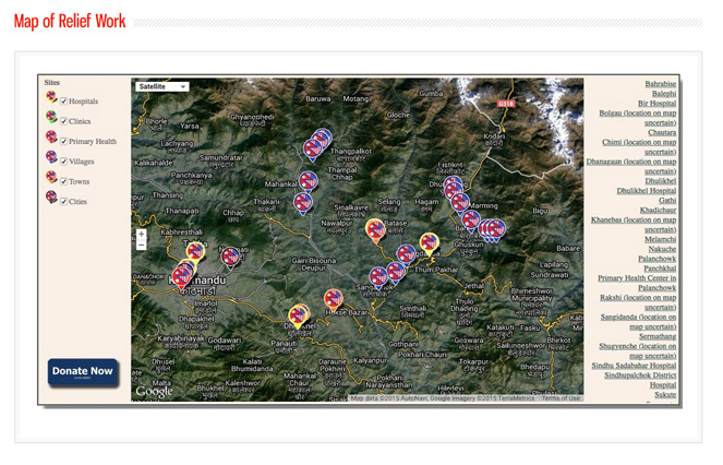
The final result, after more than three days of “punching out code and debugging,” was a publicly accessible Google Maps platform for the America Nepal Medical Foundation to track community needs and the immediate effect of donor contributions.
Since the day of the earthquake, the foundation has been providing acute medical needs, food, and shelter. It is now supporting long-term goals that involve public health, physical and psychological rehabilitation, and rebuilding of health infrastructure destroyed by the earthquake.
“The map provides a repository of information for workers in offices and in the field in Nepal,” said Shepardson, associate chair of anthropology at Northern Arizona University. “It also provides great value as a transparent means of giving confidence to donors that their generosity leads to effective results.”
Shepardson’s geo-referenced database is designed to be user-friendly so that updating the interactive webpage is as simple as updating a spreadsheet. When millions of lives are disrupted in a tragedy that extends far beyond the initial event, simplicity can make a life-saving difference.
The project, which Shepardson has already handed off to the foundation for long-term use, traces its roots to his archaeological work on Easter Island. After years cataloging the iconic moai statues there, he created an interactive database to make the information more available to the public. He later realized an even greater need existed throughout the Pacific region to move information from paper archives to a publicly accessible digital format. But the complications of industry-standard geographic information systems software stood in the way.
“I started to think what we really needed was a very user-friendly way to develop an interactive Google Map that can store multimedia data in a way that is intuitive to the user and easy to update,” Shepardson said.
Shepardson even conducted a tutorial on the NAU campus using the approach. “I had students pumping out their own interactive Google maps in 20 minutes,” he said.
But the scale of the Nepal earthquake and the resulting relief effort introduced layers of complications. Shepardson said his parents, with long-time ties to the America Nepal Medical Foundation, made the connection that put his skills to work.
Shepardson, who was worried about the fate of family friends, decided that the end-of-semester academic push would not deter him.
“For a project like this, at a time like this, how could I say no?”
Shepardson said the online tool, which may have applications far beyond its current use, will likely be used long after the Nepal earthquake has dropped from public attention.“The relief effort will go on for months or years,” Shepardson said.
“These are not just crisis mode web pages. I hope to see them updated and used for a long time to come.”


