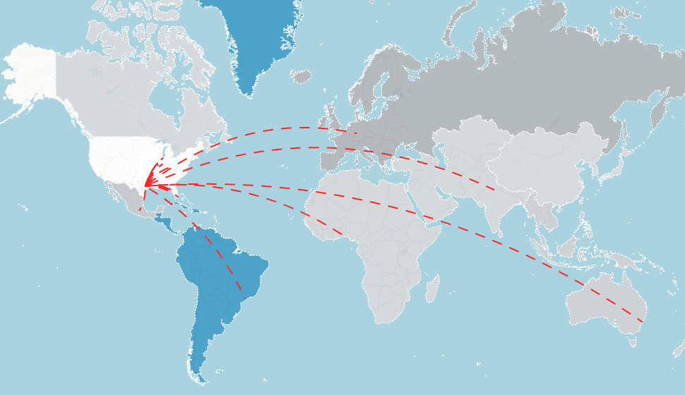
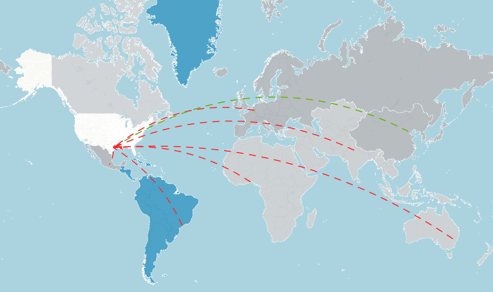
With Hurricane Laura bearing down on the Gulf Coast, the potential for disruptions to the nation’s fuel and shipping infrastructure is significant, according to data scientist Ben Ruddell, director of the FEWSION project at Northern Arizona University and a leading expert on supply chains. This means that cities and counties throughout the nation and in other parts of the world could see increased prices or fuel shortages, depending on the storm’s impacts.
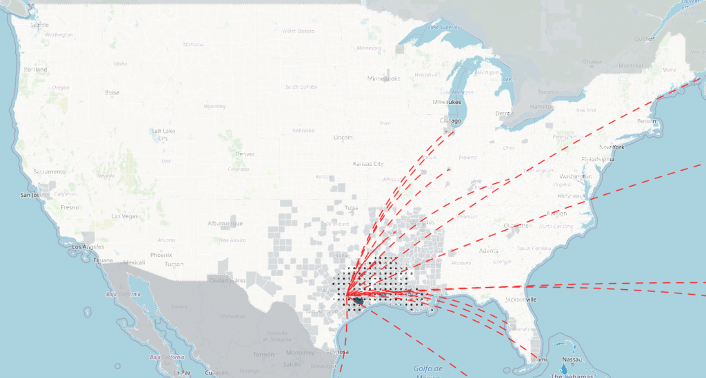
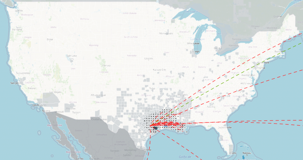
The FEWSION team, using the FEW-View supply chain analysis tool available, has released a map and analysis of possible impacts to national and global supply chains during the first day of landfall from the combined hurricanes (or tropical storms) Laura and Marco, expected later this week. According to the NOAA-NWS National Hurricane Center, Hurricane Laura is projected to impact East Texas and Louisiana, especially the coastal region including Houston and New Orleans.
The Gulf Coast region contains the world’s greatest concentration of oil, gasoline and natural gas infrastructure, including many drilling platforms, refineries, pipelines, storage facilities and shipping terminals. This region is responsible for roughly $1 trillion a year in economic production—much of that concentrated in the fuel sector. Much of the fuel consumed in the central U.S. (between the Rocky and Appalachian mountains), especially in Texas, Louisiana, Alabama, Illinois and Florida, as well as the Caribbean and other parts of the world that import fuel from the U.S., comes from facilities in this area. If there is widespread damage to that Gulf Coast fuel infrastructure, people and companies who depend on fuel from the U.S. Gulf Coast can expect increases in fuel prices or even shortages if the damage is severe enough.
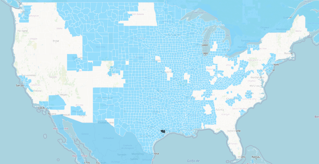
“These maps don’t mean your supply chain will be disrupted, but it shows you that there is a chance your supply chain will be disrupted if efforts to protect facilities on the Gulf Coast are unsuccessful,” Ruddell said. “Importantly, this map also tells you that many communities’ supply chains on the East Coast and West Coast of the U.S. are not exposed to the storms, so those supply chain managers and emergency managers can sleep easier with this information.”
The main terminal exporting liquefied natural gas from the United States is located in the center of this area, and it could be strongly impacted by Laura, especially if flooding from Marco is already serious when Laura arrives. Many oil-derived petrochemicals are also produced in this region and could be disrupted.
Bulk grain shipments from the breadbasket region of the central United States are exported around the world (for example, soybeans to China) from the ports surrounding New Orleans.
“If a large fraction of your upstream supply chain is located in the impact area, you should take steps to ensure that you know as quickly as possible how well your suppliers weather these storms, and you should prepare for contingencies in case there are disruptions,” Ruddell said.
In 2017, efforts to protect the fuel supply chain in Houston during Hurricane Harvey were largely successful, which limited damage to the national fuel supply chain to a moderate price increase for fuel in the central United States following the storm. FEWSION scientist Richard Rushforth successfully predicted that impact during Hurricane Harvey in August 2017.”
The FEWSION project is funded by the National Science Foundation and the U.S. Department of Agriculture to map the nation’s supply chains and study their resiliency and vulnerability. FEWSION is led by Northern Arizona University professor Ben Ruddell and includes a team of dozens of scientists at universities and laboratories around the nation, especially the Decision Theater at Arizona State University that operates the FEW-View mapping system.
