


Jan. 10, 2019
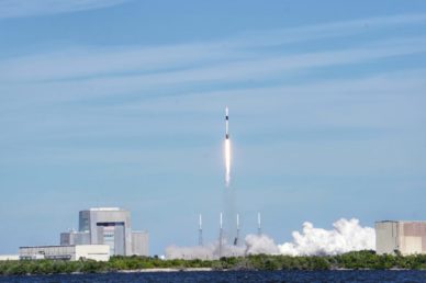
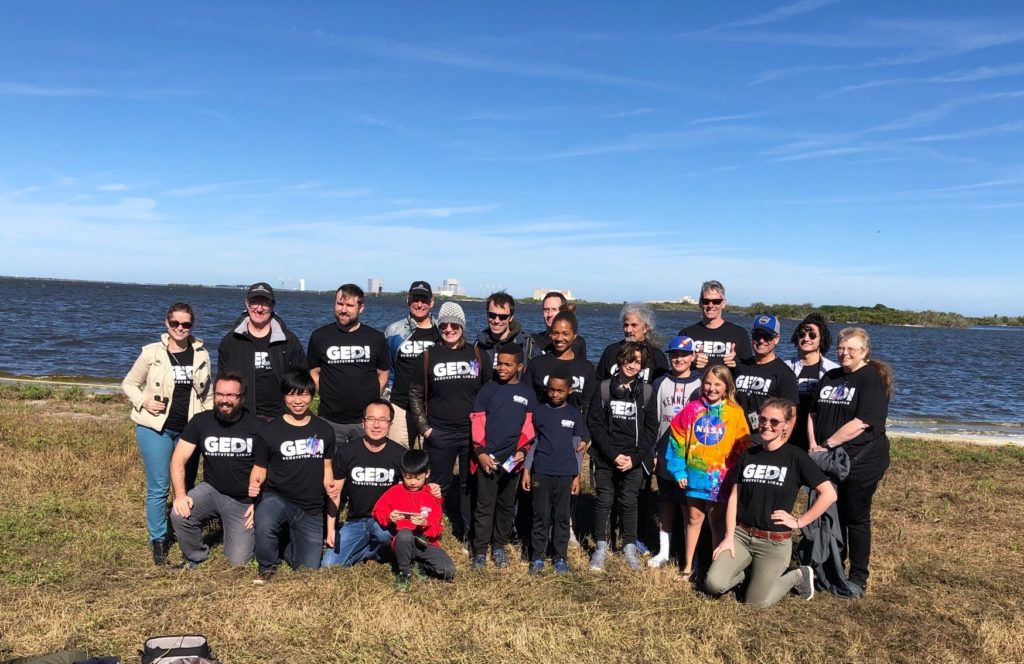
On Dec. 5, the SpaceX Commercial Resupply Mission 16 successfully launched from Cape Canaveral, carrying a groundbreaking payload in the Dragon capsule of its Falcon 9 rocket to the International Space Station (ISS)—NASA’s $94 million Global Ecosystem Dynamics Investigation (GEDI) instrument. Scott Goetz, a professor in the School of Informatics, Computing and Cyber Systems at Northern Arizona University and a member of the GEDI team, was there to watch the launch and cheer along with the crowd.
“The SpaceX launch of GEDI is something I am unlikely to ever forget,” Goetz said.
As the deputy principal investigator for science for the GEDI mission, Goetz has been involved with the project since its inception, working toward this goal for nearly 20 years in collaboration with Ralph Dubayah of the University of Maryland, College Park and NASA’s Goddard Space Flight Center.
“The SpaceX Falcon 9 rocket was extremely impressive! Even though we were three miles away, the noise was deafening. It was even more exciting than I’d imagined, especially given the successful launch of the precious cargo we have been working on for so many years to bring to fruition.”
GEDI measurements to yield new insights into carbon storage and release
Land management and climate change are fundamentally altering Earth’s tropical and temperate forests, but scientists don’t have a complete picture of their impact on global ecosystems. GEDI is designed to provide the missing piece in NASA’s observational assets—3D structure—by capturing high-resolution vertical profiles of forest, stems, branches and foliage all over the planet.
“These measurements will enable us to better understand how the Earth behaves as a system and guide the actions we can take to sustain critical resources,” Goetz said.
The size of a refrigerator, the GEDI instrument is a geodetic-class light detection and ranging (lidar) system comprised of three lasers firing 242 times per second. Soaring over both the dark and light sides of Earth at 17,150 miles per hour on the ISS, GEDI is expected to capture at least 10 billion cloud-free samples over its two-year lifespan. Data generated by GEDI will enable the science team to create an intricate three-dimensional map of forest canopies with unprecedented accuracy, yielding new insights into how forests are storing or releasing carbon. Along with Goetz, assistant research professor Patrick Jantz and research associate Pat Burns have worked as part of the mission’s science team to develop algorithms and an array of derived data products that will take advantage of the GEDI lidar measurements.
These data products will be useful for a range of science applications with societal benefits, including models of carbon and water cycling processes, habitat mapping for biodiversity assessments, weather forecasting, forest management, glacier and snowpack monitoring and more accurate elevation models of the Earth’s surface.
GEDI data expected to revolutionize research in terrestrial ecosystem dynamics
“When the data from GEDI reaches the science community, we will see a revolution in research and applications related to terrestrial ecoystem dynamics, including forestry, biodiversity and hydrology,” Goetz said. “Anything researchers do that requires information about global forests will be advanced by the data and by the derived data products generated by the science team.”
The NAU researchers will use these data products in many different ways to advance scientific knowledge of terrestrial ecosystems.
“I am excited about incorporating much-improved forest carbon stock and canopy structure changes in policy-oriented applications that inform international sustainable development goals and the UN Convention on Biological Diversity, including specific targets focused on protection, restoration and sustainable management of terrestrial ecosystems,” Goetz said. “I can hardly wait to work with the data, and I know I’m not the only one!”
Burns, who has been working on the GEDI project since joining NAU in 2017, is focused on the relationship between canopy structure and biodiversity, using simulated GEDI data to model bird species distributions in California.
“We’re working with partners from a NASA-funded project to determine the utility of simulated GEDI data for predicting bird species presence across Sonoma County,” he said. “GEDI will enable us to better parameterize canopy structure, and we hypothesize that this new information will improve our ability to model bird (and other) species distributions around the world.”
Countries around the world will benefit from GEDI
Countries around the world, particularly tropical countries that have rich forest and biodiversity resources, will benefit tremendously from being able to track the status and trends of these resources. Jantz and Burns recently returned from a trip to Colombia, where they conducted workshops introducing forest ecologists and conservation practitioners to tools and techniques for working with GEDI data.
Jantz, who has been working on the GEDI project since 2015, also has been developing metrics to quantify how vegetation structure varies across ecosystems and what this means for policies that aim to conserve plants, animals and ecosystem services.
“I am working with agencies in Colombia, one of the most biologically diverse countries in the world, to incorporate GEDI data into their national biodiversity observation system. As part of this effort, we are developing a vegetation structure Essential Biodiversity Variable (EBV),” he said. “EBVs are the result of a coordinated, international effort to identify and develop a set of variables that capture the essential dimensions of biodiversity and that can be used to assess progress towards the targets of the Convention on Biological Diversity.
“Before GEDI, we had no way to systematically map the detailed 3D structure of vegetation. This 3D structure is hugely important for biodiversity, and thanks to GEDI, our group will now be able to develop a vegetation structure EBV that can be used to identify and prioritize areas for biodiversity management and conservation in Colombia and beyond. It really was impressive to see how the years of work by engineers and scientists culminated in the successful launch of a sensor that will map details of forest structure in the most remote and wild parts of the Earth. It feels like the start of a journey of discovery.”
The mission garnered both scientific and mainstream coverage in worldwide media, including Science, the Daily Mail, Phys.org and Astronomy.com.
Goetz has been conducting satellite remote sensing research for environmental science applications for more than 30 years, having both organized and served on numerous working groups for the Intergovernmental Panel on Climate Change (IPCC), the United Nations programs on Reducing Emissions from Deforestation and Forest Degradation (REDD), the U.S. Global Change Research Program, the U.S. National Academy of Sciences, as well as NASA and National Science Foundation programs on Arctic and carbon cycle science, climate change and terrestrial ecology. In addition to being the Deputy Principal Investigator for Science of GEDI, he is the Science Lead of NASA’s 10-year Arctic Boreal Vulnerability Experiment (ABoVE).
 Kerry Bennett | Office of the Vice President for Research
(928) 523-5556 | kerry.bennett@nau.edu