


Every year at Grand Canyon National Park, millions of visitors from all over the world stop at one of a dozen water spigots. Most people are on a rim, seeing the canyon’s majesty for the first time, when they step off the trail to refill a water bottle. Others are deep in the belly of the canyon, sweaty and tired, facing a hike up in punishing heat, filling their reservoirs and dumping water over their heads to avoid dehydration and heat stroke.
All that water comes from one place: Roaring Springs, a cave-fed spring on the North Rim. You can see and hear it from the North Kaibab Trail, though no trail approaches it. It’s a lifeline for the canyon and everything that lives in it—humans, plants and animals—and it’s increasingly at risk as the climate gets warmer and drier.
Researchers in NAU’s School of Informatics, Computing, and Cyber Systems are leading research that maps Roaring Springs and other cave-fed springs. A new grant, funded by Grand Canyon National Park, will expand mapping across the park to understand how the snow and springs are connected.
“Understanding where the water sinks is critical for the infrastructure, the animals, the plants and the rest of the ecosystems that rely on these springs,” said Blase LaSala, a Ph.D. student in ecoinformatics. “They’re like oases.”
Read the early findings of his research, published in August in Nature Scientific Reports.
What to know about Grand Canyon’s caves
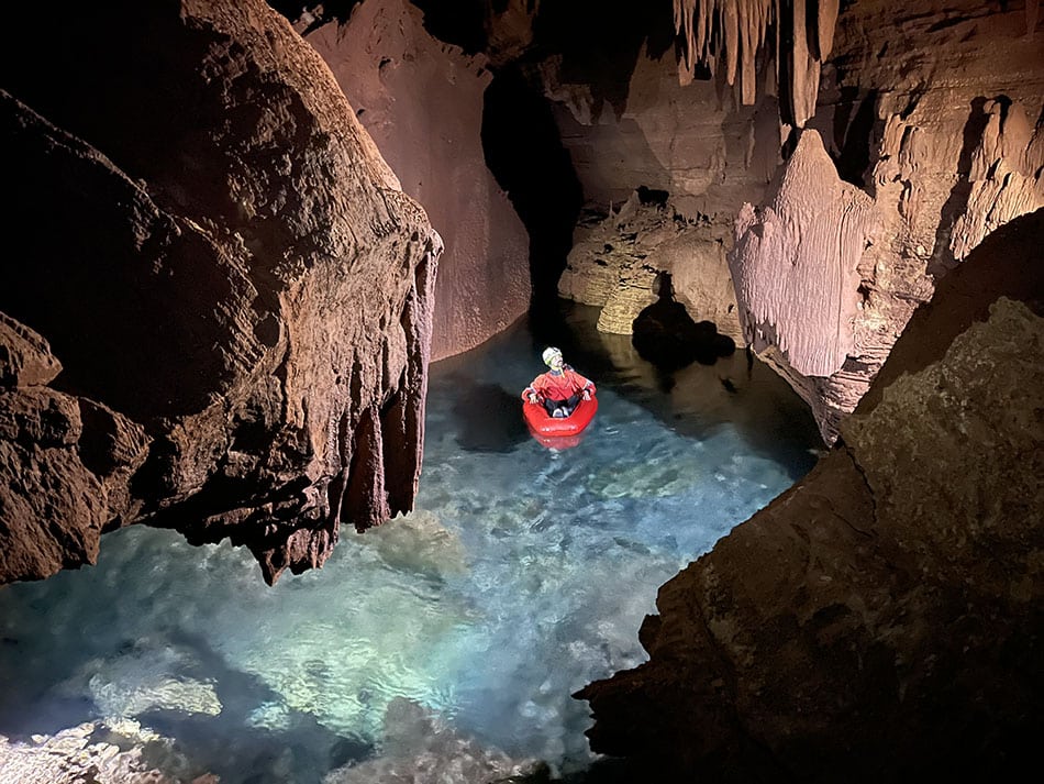
Since most of us will never go in the caves—they’re not open to the public and most are far away from any trail—our knowledge comes from mapping projects like the one LaSala did for his dissertation with professor Temuulen “Teki” Sankey, who is an expert in remote sensing. LaSala’s work used a mobile lidar sensor, which enabled him to create detailed 3D models of three caves, including the walls and ceiling. He and teams of park researchers and volunteers documented more than 10 kilometers of subterranean crawls, rooms and passages in 45 days.
“I had no idea how large and long these caves are,” Sankey said. “We have been able to produce really high-resolution 3D maps, which, from a remote sensing perspective, is what’s unique and novel about it. Grand Canyon’s caves have never been mapped in 3D like this.”
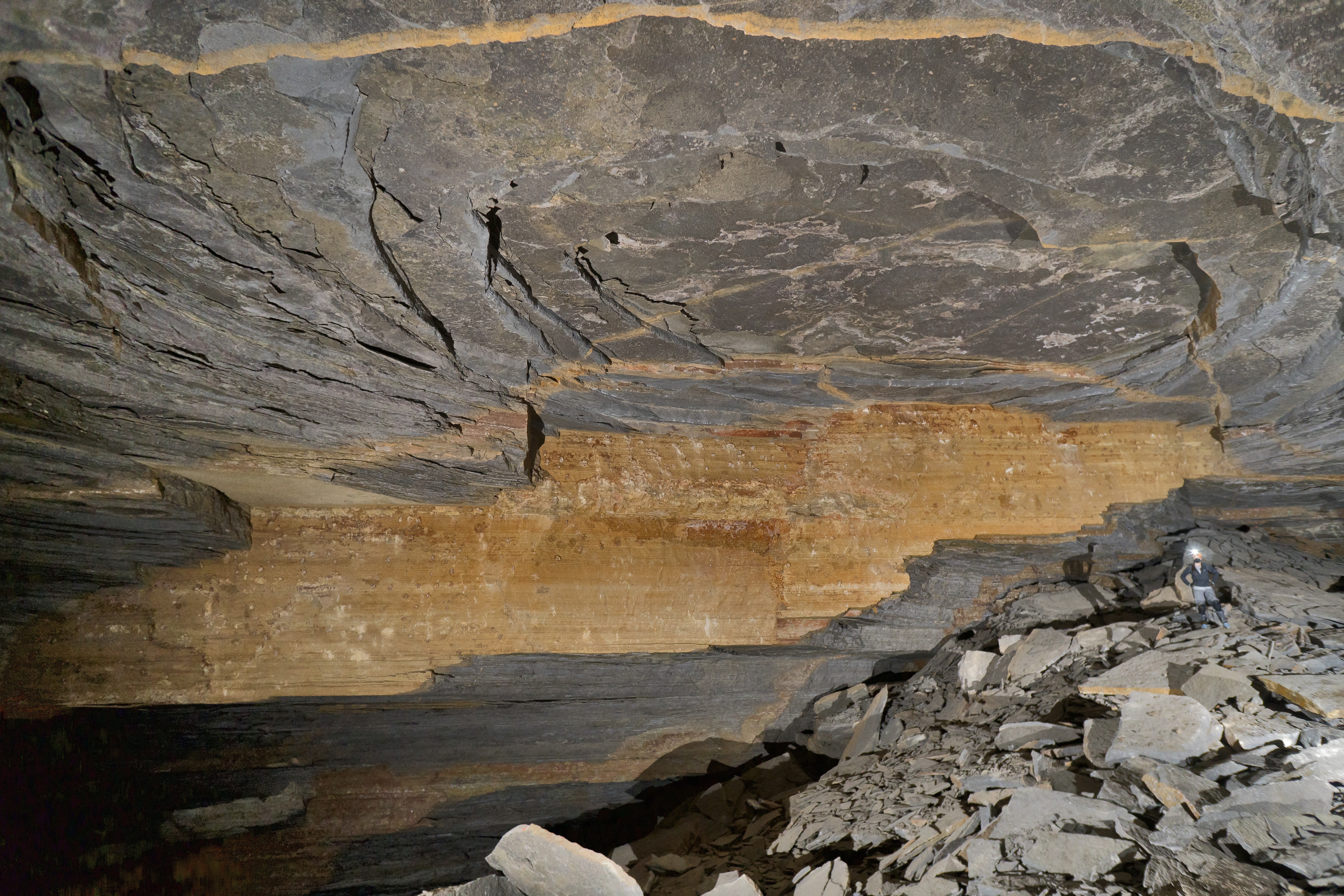
The teams hiked to the caves—up to two days each way—carrying 55-pound packs, including the mobile lidar equipment. They hiked, rappelled and floated through flooded passages to create these detailed maps, taking note of each cave’s shape and its cracks. Cave formation follows specific rules, and patterns from networks of caves tell a story about what’s happening as water moves through the many layers of rock.
Where does the water come from?
Easy answer: mostly the surface. It’s almost entirely snowmelt from the Kaibab Plateau.
But how it gets to the springs and what it picks up along the way is much more circuitous.
Most of us have seen graphics showing the different rock layers in the Grand Canyon. The cave-fed springs are in Redwall and Muav limestone; several other rock layers separate them from the surface of the Kaibab Plateau. Dye tracer tests led by the park have shown that water moves quickly through these layers; Abe Springer, a professor in the School of Earth and Sustainability and a collaborator with Sankey and LaSala, has worked with the park to drop dye into sinkholes on the surface that traveled about 20 kilometers to springs in as little as a week.
But the paths it takes to get there depend on the cracks and faults within the rock, the porousness of the rock and more that researchers just don’t know.
“The dissertation work was making the geologic connection between what we might see at the surface versus what we might see hundreds or thousands of feet belowground,” Sankey said.
“It’s like looking at a black box,” LaSala added. “You see what comes in and what comes out, but it’s very hard to quantify what’s going on in there. Now that we know what patterns are there, we can really start to relate the data to spring change over time.”
One big question is contamination. The biggest springs in the Grand Canyon are karst-fed springs, which Sankey described as the “Swiss cheese” of rocks. The speed the water can flow through the caves and cracks leaves little time for filtration. If runoff from burned areas, or E. coli, flows into sinkholes connected to Roaring Springs Cave, the park may need to halt the pumps until it can resolve the issue. Identifying where contaminants come from helps park officials address the source of the problem, preventing future water supply shutdowns.
What this new project entails
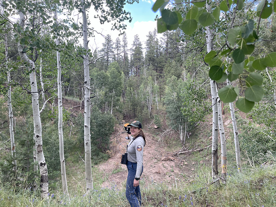
A new phase in this research will begin in early 2026. Using airborne lidar and satellite data from the last several decades, LaSala and Sankey will map the sinks on both sides of the canyon and track snowmelt accumulation in the last 40 years.
Most of this fieldwork will be on the surface—though if they find caves, LaSala’s happy to jump in and explore further with mobile lidar—and will result in a better understanding of the geologic controls that cause sinkhole collapse and disappearing streams. They’ll look for similar patterns of growth, movement and fault activity as they did in caves, which will help determine how water flows through the uppermost rock layers and will inform future dye tracing tests.
Snowmelt is a particularly timely question, as Arizona has seen less snow over the years, and the Grand Canyon is no exception. This study will create a large data archive that, combined with lidar and other image sources, will help scientists and resource managers understand the water system dynamics across the region.
This research will help Grand Canyon National Park, but its findings are more far-reaching than northern Arizona; more than 1 billion people worldwide rely on karst springs for water, so modeling how water moves through karst systems is applicable globally. It also may be of use to Native American tribes who are in or adjacent to the park.
“It’s exciting to find patterns that verify the hypotheses made over 50 years ago,” LaSala said. “We have all this amazing data now, and we’re trying to combine it with other data to find useful things. There are so many places that could benefit from this type of analysis.”
How does the Dragon Bravo Fire change the research?
Both LaSala and Sankey responded to the question with a shrug. Curveballs are normal in research. This is a big one, but it won’t be the only one.
“It’s a new twist to our study,” Sankey said.
The results of the fire will change what they find along the Kaibab Plateau, and they will have to integrate its environmental effects into their work. They’ll help the park however they can in that regard, LaSala said.

Heidi Toth | NAU Communications
(928) 523-8737 | heidi.toth@nau.edu