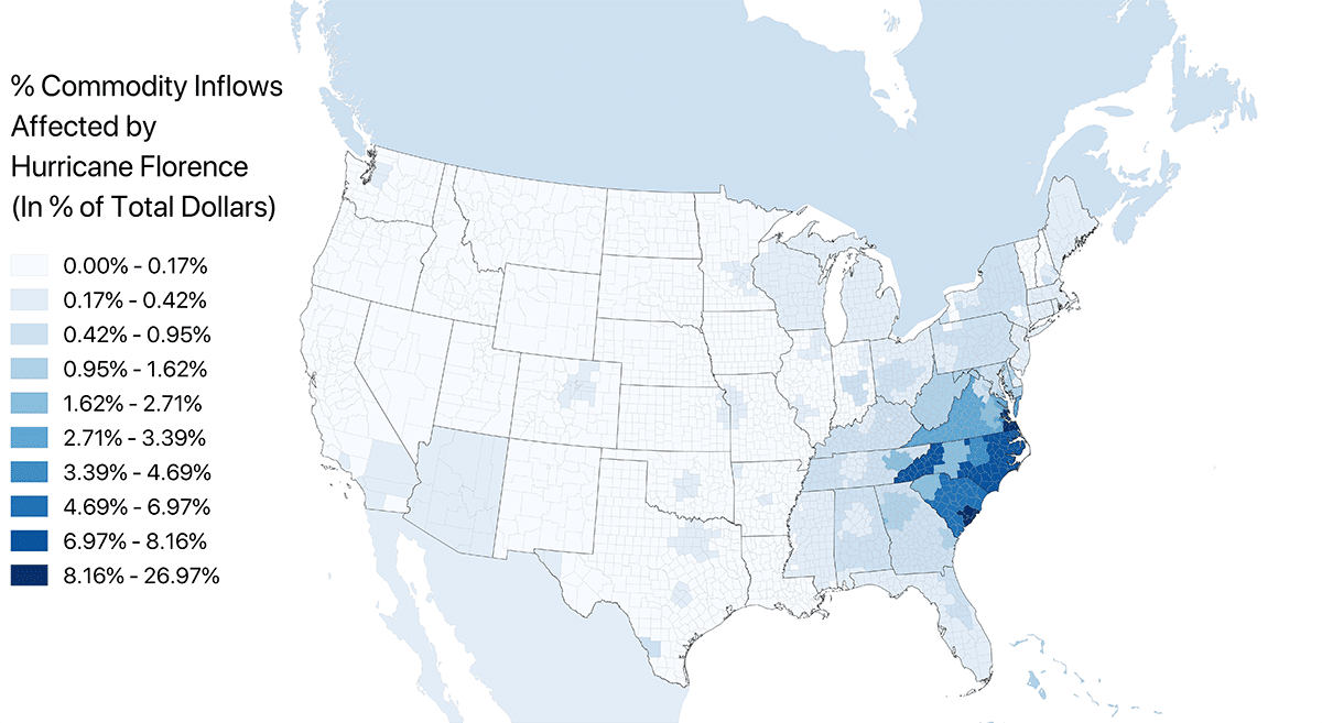
Hurricane Florence is reported by the U.S. National Weather Service as making landfall as a Category 1 storm (U.S. scale). The areas that are projected to be affected the most by 2018 Hurricane Florence—counties that have been asked to evacuate prior to landfall—are less populated than the areas affected by the 2017-year hurricanes Harvey, Irma, Nate and Maria. Some of the urban areas that are being directly impacted are the mid-sized cities of Wilmington, North Carolina; Charleston, South Carolina; and the Hampton Roads region of Virginia (Norfolk and Hampton). A broader impact to U.S. supply chains from Hurricane Florence is less likely than, for example, 2017’s Hurricane Harvey because that storm hit Houston, which is one of the world’s leading oil, gas and chemical industry supply hubs. Therefore, while Hurricane Florence is a major, life-threatening storm, supply chain exposure is severe only in the Mid-Atlantic and Carolina coast region of the United States.
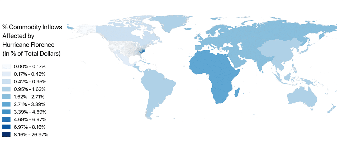
However, since the Port of Charleston in Charleston is a major U.S. port for goods such as paper, auto parts, logs/lumber/wood, poultry, meat and automobiles, there may be a modest global supply chain impact if the port becomes flooded or has to shut down for any reason. While the major trading regions in total dollars are Europe, Eastern Asia, India and South America, in terms of the percent of total trade from the United States with global regions, Africa seems to be the most affected global trading region.
The FEWSION project of Northern Arizona University is a National Science Foundation-funded research network (ACI-1639529) that maps and analyzes supply chains, including critical food, energy and water supply chains. This bulletin provides a near real-time analysis of the exposure of a community’s supply chains to major events.
FEWSION director Ben Ruddell noted that because FEWSION is a basic science project, all data and analysis must be used with caution and are strictly provisional; no liability is assumed by FEWSION, NAU or their funding partners. The opinions expressed are those of the researchers, and not necessarily the funding agencies. Ruddell is available to provide additional information, analysis and data.
Contact: Ben Ruddell, associate professor in the School of Informatics, Computing, and Cyber Systems, (928) 523-3124 or benjamin.ruddell@nau.edu