


July 22, 2019
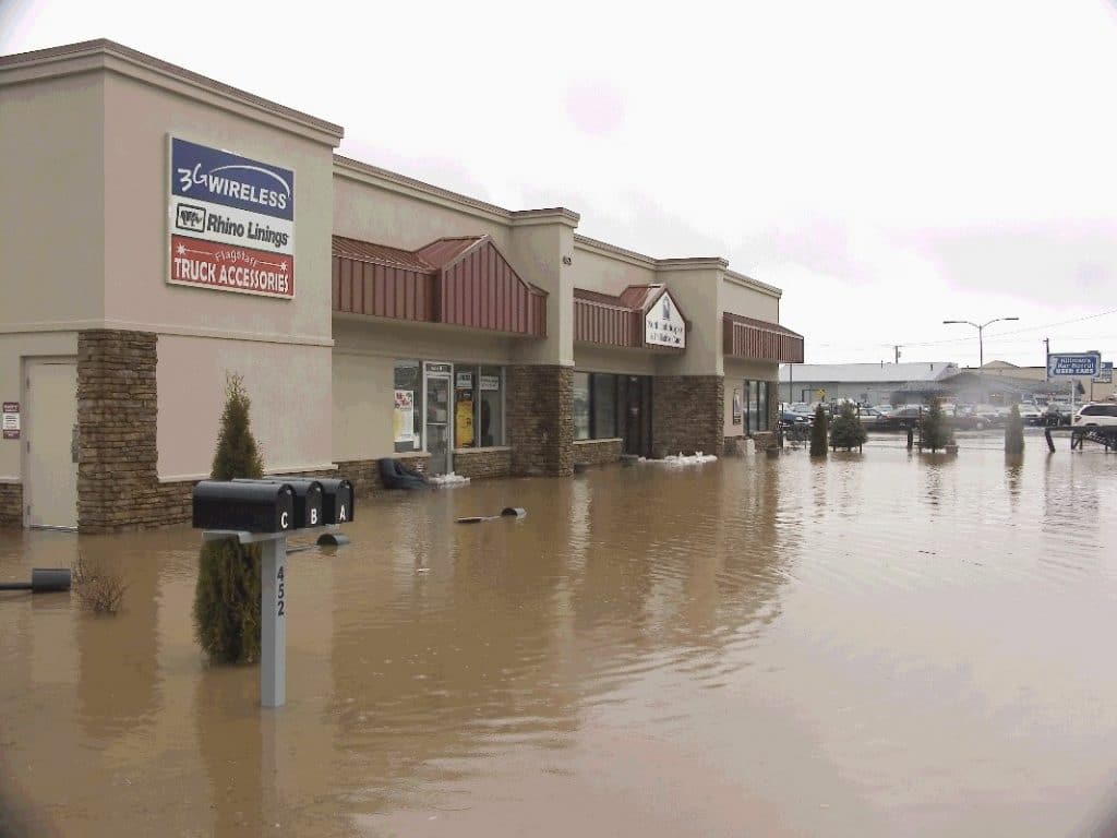
In a world of smart watches, smart homes and smart appliances that monitor their environments to keep users safe and informed, can whole cities be smarter? Short answer: Probably, using cutting-edge information technologies to keep citizens and property safer. The long answer: NAU researchers Eck Doerry and Ben Ruddell aim to find out through their FloodAware project, which allows them to explore what it would mean for a city to be “smart” about floodwater management.
“We realized that cutting-edge hydrological modeling, image processing and real-time sensing techniques could be brought together to help citizens, city administrators and first responders better react to flooding and, ideally, be warned of imminent flooding before the water arrives” said Doerry, a professor in the School of Informatics, Computing, and Cyber Systems (SICCS). “The system will integrate numerous data streams to calculate real-time maps of current and upcoming flooding and can then send a notification to citizens in endangered areas. This is really what being a smart city means to us: the city keeps an eye on threats and warns citizens in appropriate ways.”
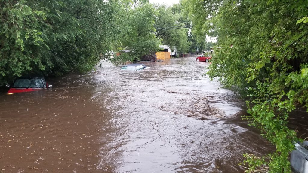
The key to making all of this happen is finding clever, low-cost, low-impact ways to gather accurate water level readings in real-time from as many places around the city as possible. Most cities, including Flagstaff, already have some flow monitoring equipment placed in various washes and drainages around the city. The challenge in getting more of this equipment is the sensors are so expensive that neither the city nor FloodAware can afford many of them.
The solution explored by the FloodAware project is to develop smart image processing techniques to determine water level from a simple snapshot image. If this could be done, researchers could piggyback on the hundreds of cameras already in place in the city to control traffic lights, monitor intersections and deploy as public webcams.
Citizens will soon be strongly encouraged to participate in making their city smarter as well.
“When a simple snapshot image becomes a valuable data point, every citizen with a cell phone will be able to contribute to improving flood map accuracy, as well as get real-time information on flood dangers right on their cell phone,” Doerry said. “Citizen-contributed readings collected in this way can make a huge difference. We’ll never have enough cameras to cover all places that flooding happens. People tend to take pictures of flooding anyway to show their friends, and this could provide a high-volume data stream right when and where we need it, right where flooding is the worst.”
As the project moves into its second year this fall, residents will be able to download a prototype of the FloodAware mobile app to their smartphones. Whenever they see flooding happening, they can snap a picture with the app, which will use smart image processing to determine the water depth and integrate this reading into the evolving flood maps on the central server.
This approach to data collection using citizens and their cell phones as a powerful data stream is called “crowd-sourcing” and has already proven its value in numerous other contexts. For instance, the popular traffic navigation app Waze uses crowdsourcing to generate timely and accurate information on urban traffic flows to help users avoid slow-downs or jams.
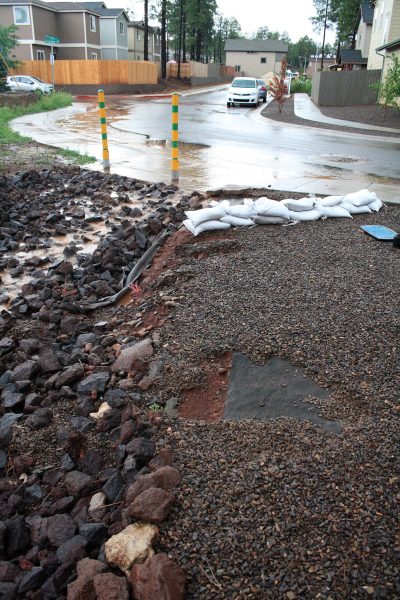
“The city is excited to partner with NAU in developing technologies that will help with public safety and designing flood resilient communities,” said Edward Schenk, stormwater section project manager for the city of Flagstaff. “The timing of this study works well with moving forward with the Rio de Flag Flood Control Project and the rapid expansion of our own real-time rain and stream gauge flood alert system. The camera system can work well in neighborhoods historically known to flood, while traditional stream gauges can continue to provide flood monitoring in the washes and streams, combining these two sources of data will help scientists and engineers determine how to improve storm water drains, pipes and detention basins.”
In the initial year of the project, the focus has been on developing the fundamental technologies and algorithms needed to make FloodAware a reality. In addition to the city’s traffic control cameras around town, the team has developed specialized solar-powered camera systems that will allow them to explore what kinds and resolution of images are best suited to drive the smart image processing algorithms that determine water level from a snapshot. A total of 10 of these cameras are being installed in flood-prone locations in Flagstaff and Phoenix.
These cameras, which don’t move or take video and are narrowly focused at the curb level, will take and upload snapshots at frequencies ranging from once every 24 hours to a maximum of once per minute during heavy rain events. The snapshots are sent to the central FloodAware server, which applies artificial intelligence and other algorithms to determine the water level at that point. Combining all such values from all cameras will allow the system to generate a real-time flood map. From there, feeding all current water levels into the real-time modeling system will allow predictions of imminent flooding. The flood maps generated in this way would then be made available, both through a website and the FloodAware mobile app, to city officials, first responders and citizens.
Put all of this together, Doerry said, and you get the big picture: Creating a simple “shrink-wrapped” flood monitoring solution complete with camera recommendations, algorithms and tools needed so any city manager anywhere in the country can easily connect their community into a nationwide FloodAware smart city network. In the even bigger picture, having thousands of FloodAware smart cities online across the nation will provide enormous new streams of high value urban water flow data to feed the national water model being developed at NOAA’s new National Water Center with the ambitious goal of understanding water movement across the entire surface of our nation.
The FloodAware project is funded through a Smart & Connected Communities (S&CC) grant from the National Science Foundation (#1831475). The purpose of the S&CC program is to use innovative technology to make U.S. cities smarter and make life in urban areas more efficient, safe and fast. It also requires grantees to discuss how to make their project sustainable in the long-term for their and city and others throughout the country.
“The city of the future will be smart and connected, and that includes connecting people with much more rapid and more accurate information about flooding in their community,” Ruddell said.
People interested in learning more about FloodAware can contact Doerry and Ruddell at Benjamin.ruddell@nau.edu and Eck.Doerry@nau.edu. In the meantime, keep an eye out for the flood cameras, flood gauge signs posted at key washes and flooding areas around Flagstaff and Phoenix.