


Snowpack can be difficult to measure in the rugged, varied terrain of northern Arizona’s forests, and warming winters only complicate the picture. But a careful look into the past, layered with scrutiny of the present, reveals some welcome findings.
After analyzing thousands of images from satellites and airplane-flown sensors, Teki Sankey, Northern Arizona University ecologist and remote sensing scientist, concluded that forest thinning increases snow accumulations on the ground and allows snow to linger during the spring melt. The combined effects increase the groundwater recharge that contributes to Arizona’s water supply.
Sankey’s analysis, funded by the Bureau of Reclamation and published in Remote Sensing of Environment, was motivated in part by the potential of the Four Forest Restoration Initiative. The initiative, known as 4FRI, has a goal of restoring 2 million acres to a more natural distribution of trees.
“It’s very important to know what that will do to the current distribution of snow, and if the restoration treatment will be beneficial,” Sankey said.
Sankey called five sites in the Centennial Forest near Flagstaff “ideal” for snow accumulation because experimental thinning treatment there has resulted in a 24 percent forest canopy cover. Too much canopy results in snow not reaching the ground and therefore not effectively recharging ground water, she explained. Too little canopy means snow not remaining on the ground long enough to be of the most benefit.
Sankey gathered high resolution images at those sites through the use of a hyperspectral sensor flown in an airplane.
“These results are encouraging for 4FRI,” Sankey wrote, noting that areas treated to that level “appear to have an optimum threshold for accumulating and maintaining snowpack.”
A more expansive regional analysis was performed using 20 years of coarse resolution satellite images. Sankey “stacked” 3,000 daily images of pre- and post-treatment areas throughout Arizona. Her painstaking analysis of the images—to her knowledge, the first of its kind at that scale in Arizona—benefitted from the processing power of NAU’s Monsoon computing cluster.
According to Sankey, the data analysis indicated an increase in snow cover in treated areas. In a planned follow-up paper, she will analyze data from soil moisture sensors to determine the extent of increased moisture benefits.
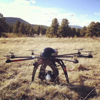
Over the coming winter, Sankey will also fly her octocopter unmanned aerial vehicle with a high-resolution three-dimensional lidar sensor to measure the thickness of the snow distribution in the treated forest sites. The analysis from the 3-D data will determine if thinning increases snow depth in addition to snow cover on the ground.