


For Northern Arizona University ecologist and remote sensing scientist Teki Sankey, conducting research has usually meant interpreting coarse pixels from satellite images to draw conclusions about the vegetation covering landscapes worldwide.
Now, by flying a custom-engineered octocopter packing two powerful sensors, Sankey will reap exquisite detail from forests, sand dunes and other natural features in Arizona.
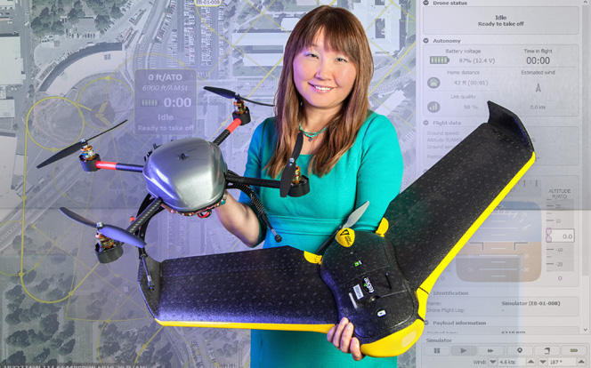
The unmanned aerial vehicle to be flown by Sankey and her graduate students will gather data.
|
“With the satellite data you can only estimate what you are seeing, so if you have several different features lumped together into one pixel, you’re going to have to label it based on the dominant cover,” Sankey said. “With the high resolution drone data, I can do a lot more.”
But the wait for that capability has proven to be a long one. While the octocopter is being assembled in Germany—and its sensors and inertial navigation system being integrated by four vendors—weeks have become months.
In the meantime, Sankey has acquired a fixed-wing drone. She and graduate students Jonathon Donald, Dan Solazzo, and Jason McVay have been flying it to study forest restoration effects in the Centennial Forest area outside of Flagstaff. What they see there has implications for the Four Forest Restoration Initiative, at this point underway on a small scale.
“We’re studying that area as an example of what will happen when 4FRI begins operations over large acreages,” Sankey said. “The idea is to see if thinning will improve the ground water budget because of the additional snow cover that will result from fewer trees.”
That work along with satellite image analysis, funded by a Bureau of Reclamation grant, will become more fine-tuned once the octocopter arrives with its unique array of equipment.
A hyperspectral sensor with 350 distinct color bands will allow Sankey to see “a particular tree species, and under that I can see a particular grass species.”
With data from a lidar scanner, which produces three-dimensional images, Sankey can determine plant height. From a Ponderosa pine, she could correlate height to age, estimate canopy volume and calculate total biomass to conclude how much carbon is stored in a tree—a number that could be of great value to forest managers.
Effectively using all that data—one hour of flight time will generate about 1 terabyte—requires the capability to process it quickly. NAU’s computing cluster, known as Monsoon, came online over the summer and has already proven to be invaluable.
“One thing that I’m very excited about is the high performance computing that NAU just got,” Sankey said. “So far, my lab group is one of the biggest users because the data volume in my research is a big challenge.”
The $200,000 drone, funded by an allotment from the Arizona Board of Regents’ Technology and Research Initiative Fund, had to be custom engineered to accommodate the two sensors and an advanced GPS system. Sankey said the only other low-altitude alternative has been to pay for images taken from an airplane, but obtaining just one quality image of a particular location could cost tens of thousands of dollars.
Yet regulations affecting flight and airspace still come into play. The rapidly expanding use of drones by researchers, and even citizens trying to obtain a spectacular souvenir photo, has the FAA scrambling to keep up. Sankey applied for a permit in April 2014 and finally received a certificate of authorization for the current project in February. So far, only one other applicant at NAU has been granted a permit to fly drones for research: Thomas Hoisch, associate dean for research in the College of Engineering, Forestry and Natural Sciences.
Limited practice flights are allowed, however, and a heavily duct-taped trainer drone in Sankey’s office is testament to the expertise required to operate one effectively. Flagstaff’s challenging spring winds didn’t help when Sankey and her students first began learning, although they were given some opportunities to practice in the calm confines of the Skydome.
Once the octocopter arrives, it won’t be ready for immediate action. Calibrating and validating the instruments it carries will take time, but Sankey has already received plenty of offers for projects on which to begin the process.
“A lot of people have heard about the drone and have come to me,” Sankey said. “I think the drone is really going to open doors for me for many collaborations on campus as well as off.”